Mountain bike riding in Logan
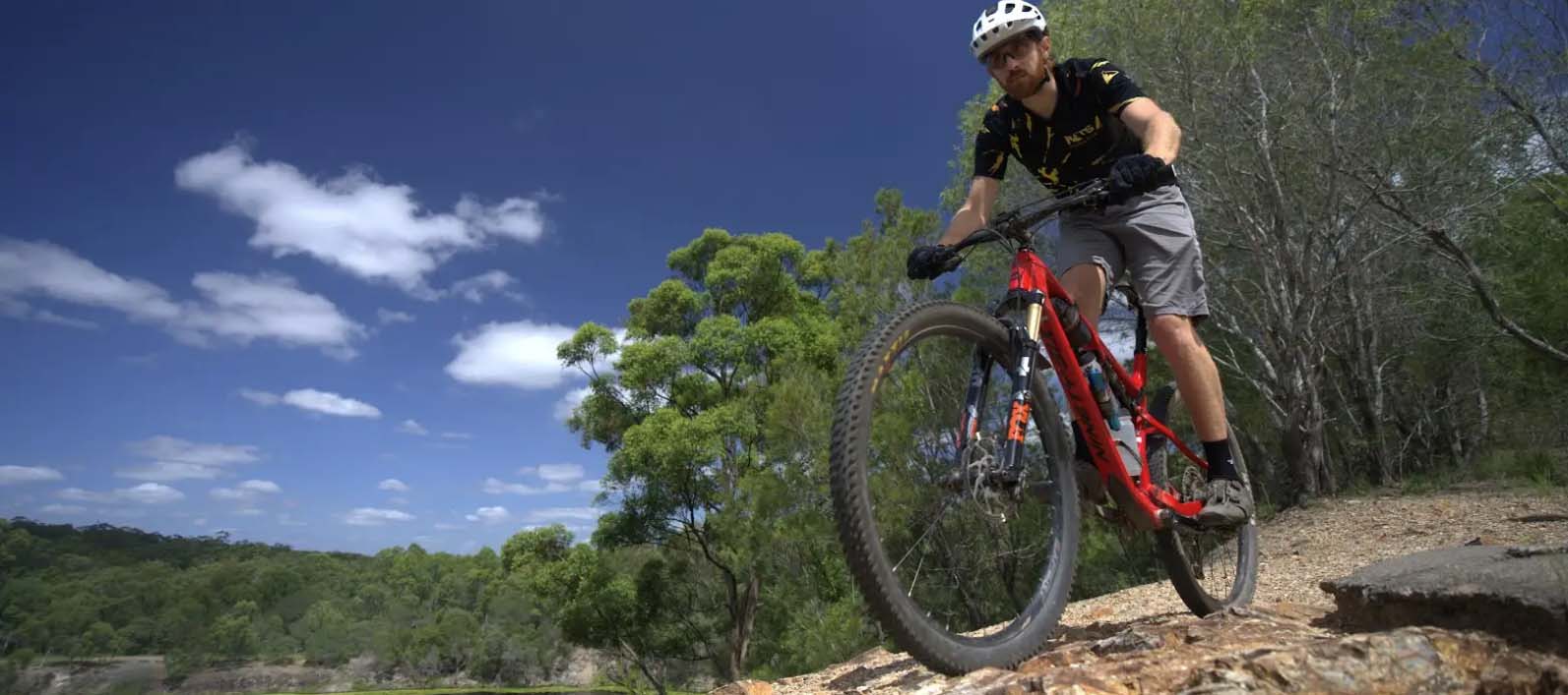
The City of Logan is home to some incredible Mountain Bike trails! Whether it’s in Daisy Hill, Cornubia, or Spring Mountain, there are plenty of quality trails catering to riders of all skill levels and experience.
Before you ride
Before heading out on a ride, assess your riding experience, fitness, and stamina. Be honest with yourself about your experience and abilities.
When selecting mountain bike trails to ride, it is important to match your skill level to the trail difficulty. Riding a trail that is too difficult for your skill level can be dangerous and lead to injury.
Use this information as a guide to make informed decisions about which trails to ride.
We recommend downloading a mobile app like Trailforks to view trail conditions and locations before you ride them.
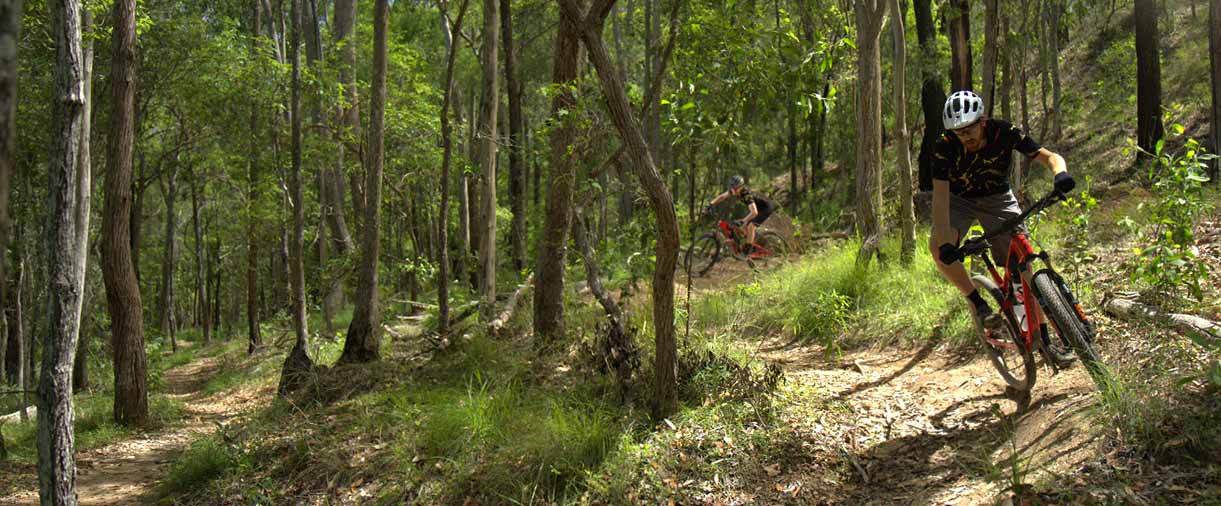
Ride safety
Tracks and trails have riding hazards such as steep downhills, drainage humps and loose surfaces.
- Limit your speed when riding downhill
- Approach drainage humps slowly
- Only ride on trails that suit your cycling abilities
- Be aware that riding conditions can change after wet or windy weather. Check the Bureau of Meteorology website before heading out
- Please check the Logan City Council Facebook page for updates on trail status.
Ride responsibly
Keep tracks in good condition by not riding during or immediately after wet weather. If your tread sinks 2 centimetre into the trail, you're doing damage!
- Always wear a helmet and appropriate safety gear
- Wear adequate sun and insect protection and carry enough drinking water
- Avoid skidding and sliding around turns and downhill to prevent collisions and minimise trail damage
- Respect areas closed to riding.
- Ride on open trails only
- Keep group rides to fewer than 12 people, if possible
- Ride according to trail conditions.
Mountain Bike Trails in Logan
Plan your next Mountain Bike adventure in Logan!
Trails listed on this website are owned and managed by City of Logan.
Cornubia Forest Park
Visit the Trailforks map for location.
| Trail name | Trail length | Trail difficulty |
|---|---|---|
| Birdwing | 3.1 kilometres |
|
| Cycas Court Access | 275 metres | |
| Flowmy Loamy | 220 metres |
|
| Escarpment Break | 1.1 kilometres |
Fire Access DoubleTrack |
| Ginger Gully | 1.2 kilometres |
|
| Gramzow Road Link | 1.7 kilometres | |
| Kimberley Drive Break | 395 metres |
Fire Access DoubleTrack |
| Lookout Break | 373 metres |
Fire Access DoubleTrack |
| Parkview Break | 1.1 kilometres |
Fire Access DoubleTrack |
| Parkview Crescent Access | 530 metres |
|
| Resurrection | 400 metres | |
| Saddle Break | 254 metres | Fire Access DoubleTrack |
| Spangled Drongo | 1.8 kilometres | |
| Spangled Drongo Access | 135 metres | |
| Stupidly Happy | 1.5 kilometres | |
| Sugarwood Place Access | 215 metres | |
| Wallum Froglet | 1.7 kilometres | |
| Wallum Froglet Access | 140 metres | |
| West Mount Cotton Road Link | 1.7 kilometres |
Bronzewing Park (Bahrs Scrub)
Visit the Trailforks map for location.
| Trail name | Trail length | Trail difficulty |
|---|---|---|
| Billabong Trail | 780 metres |
Discovery Park (Bahrs Scrub)
Visit the Trailforks map for location.
| Trail name | Trail length | Trail difficulty |
|---|---|---|
| New Disco | 632 metres | |
| Ironbark Trail | 723 metres |
Kimberley Forest Park
Visit the Trailforks map for location.
| Trail name | Trail length | Trail difficulty |
|---|---|---|
| Nirvana | 2.2 kilometres |
Neville Lawrie Reserve (Daisy Hill)
Visit the Trailforks map for location.
| Trail name | Trail length | Trail difficulty |
|---|---|---|
| Sleepy Hollow | 394 metres | |
| Koala Access Trail | 140 metres | |
| Ripleys Link | 15 metres | |
| Gillian's | 560 metres | |
| Glider | 2.4 kilometres | |
| Grass Tree East | 792 metres | |
| Koala | 1.1 kilometres | |
| Ripley's | 2.2 kilometres |
Red Ash Reserve
Visit the Trailforks map for location.
| Trail name | Trail length | Trail difficulty |
|---|---|---|
| Red Ash Trail | 520 metres |
Spring Mountain Forest Park
Visit the Trailforks map for location.
| Trail name | Trail length | Trail difficulty |
|---|---|---|
| Batwing Trail | 400 metres | |
| Horseshoe Loop | 1.9 kilometres | |
| Monarch Trail | 2.7 kilometres | |
| Pinto Path | 1.6 kilometres | |
| Sheoak Trail | 800 metres | |
| Surefoot Trail | 1.8 kilometres | |
| Thornbill Trail | 1.1 kilometres | |
| Thornbill Access | 25 metres | |
| Thornbill Alternate | 102 metres |
Tudor Park
Visit the Trailforks map for location.
| Trail name | Trail length | Trail difficulty |
|---|---|---|
| Colony | 195 metres | |
| Heimlich Trail | 350 metres | |
| Jump Start | 155 metres | |
| Monarch | 200 metres | |
| Monstro | 185 metres | |
| Oogie Boogie | 325 metres | |
| Return Trail | 66 metres |
Underwood Park
Visit the Trailforks map for location.
| Trail name | Trail length | Trail difficulty |
|---|---|---|
| Firetrail | 980 metres | |
| Underwood Link Trail | 518 metres | |
| XCC#1 | 1.5 kilometres | |
| XCC#2 | 1.5 kilometres | |
| XCC#3 | 936 metres |
Caring for the Park
Help protect the bushland by taking the steps below.
- Stay on marked trails and roads. Shortcutting causes erosion and damages vegetation and trails
- Take your rubbish with you when you leave
- Remember everything is protected. Do not take or disturb plants or animals
- Let animals find their own food. Human food can make native animals susceptible to disease and cause annoying or aggressive behaviour.
Park volunteers
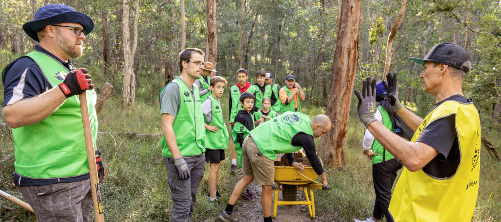
As Council adds improved mountain bike trails to the area, there are more ways to volunteer. If you like conserving and enhancing trails, consider joining TrailCare. To get involved please visit Park volunteers.